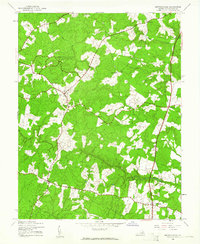
1942 Map of Spotsylvania
USGS Topo · Published 1961About this map
Spotsylvania stands at the center of this 1942 survey, reflecting a landscape deeply shaped by its military history and rural agriculture. The northern portion of the quadrangle is preserved within the Fredericksburg Spotsylvania National Military Park, marking the hallowed ground of Civil War engagements. This historical legacy is further anchored by the Confederate Cem located near the town center. Outside the park boundaries, the land is a network of small settlements and river systems, including the Ni River and Po River. Scattered crossroads such as Snell, Fraziers Gate, and Thornburg served as local hubs, while community life revolved around institutions like Zion Ch and the Lonewall Sch. The map illustrates a pivotal era before the intensive suburban expansion of later decades, showing the original footprints of the State Highway Commission roads as they wound through the Virginia countryside.
Find a feature on this map
17 named features on this map. Tap any name to fly to it.
Don’t see what you’re looking for? This feature index may not catch every label — zoom into the map to look around manually.
Map Details
Editions of this 1942 Spotsylvania Map
2 editions found

Other maps of this area

1887 · Spottsylvania
USGS Topo · 1:125,000

1889 · Fredericksburg
USGS Topo · 1:125,000

1892 · Fredericksburg
USGS Topo · 1:125,000

1892 · Spottsylvania
USGS Topo · 1:125,000

1894 · Fredericksburg
USGS Topo · 1:125,000

1926 · Stafford
USGS Topo · 1:62,500

1931 · Stafford
USGS Topo · 1:62,500

1942 · Woodford
USGS Topo · 1:31,680

1942 · Guinea
USGS Topo · 1:31,680

1942 · Ladysmith
USGS Topo · 1:31,680