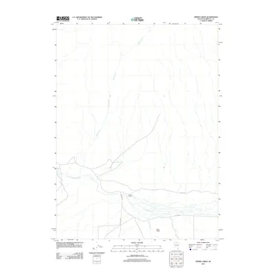
2011 Map of Spring Creek
USGS Topo · Published 2011About this map
Eden Valley defines this portion of Humboldt County, where the desert landscape is shaped by the seasonal flow of the Little Humboldt River. During the early 21st century, this remote ranching area remains centered on the Bullhead Ranch, situated near the intersection of Shelton Rd and N Fork Rd. The drainage network, including its namesake Spring Creek and the southern-flowing Eden Creek, illustrates the complex water rights and irrigation patterns essential for life in the Great Basin. This survey documents the sparse but critical infrastructure of the region, showing the primary access via Eden Valley Rd as it connects isolated homesteads to the wider county network. The map provides a clear record of the high-desert topography and the enduring spatial relationship between the river valley and the surrounding upland ranges.
Find a feature on this map
9 named features on this map. Tap any name to fly to it.
Don’t see what you’re looking for? This feature index may not catch every label — zoom into the map to look around manually.
Map Details
Editions of this 2011 Spring Creek Map
This is the sole edition of this map. No revisions or reprints were ever made.
Other maps of this area

1882 · Paradise
USGS Topo · 1:250,000

1893 · Paradise
USGS Topo · 1:250,000

1945 · Hot Springs
USGS Topo · 1:62,500

1947 · Hot Springs Peak
USGS Topo · 1:62,500

1955 · McDermitt
USGS Topo · 1:250,000

1959 · McDermitt
USGS Topo · 1:250,000

1980 · Hardscrabble
USGS Topo · 1:24,000

1980 · Spring City
USGS Topo · 1:24,000
1980 · Chimney Reservoir
USGS Topo · 1:24,000
1980 · Whiskey Springs
USGS Topo · 1:24,000