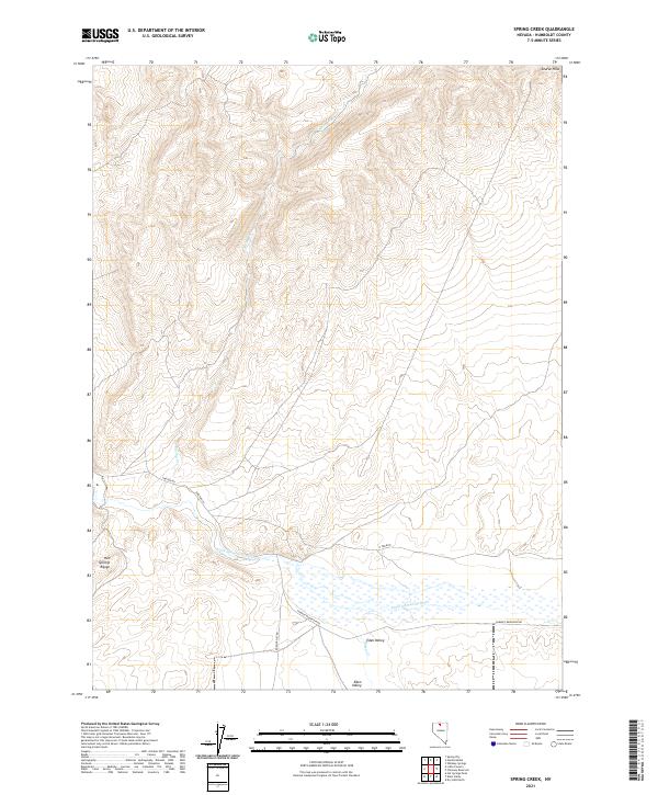
2021 Map of Spring Creek
USGS Topo · Published 2021About this map
Eden Valley occupies the southern portion of this landscape, where the Little Humboldt River meanders through a broad basin before reaching the marshy reaches near Chimney Reservoir Rd. To the northwest, the elevation rises sharply into the Hot Springs Range, a prominent uplift that overlooks the valley floor. The hydrology of the region is defined by seasonal watercourses like Spring Cr and Eden Cr, which drain the surrounding high ground toward the central river system. Local infrastructure is minimal, consisting primarily of gravel routes such as Shelton Rd and N Fork Rd that follow the natural contours of the basin. The northern boundary is marked by the Ararat Hills, providing a distinct geographic transition from the river bottomlands to more elevated, broken terrain.
Find a feature on this map
16 named features on this map. Tap any name to fly to it.
Don’t see what you’re looking for? This feature index may not catch every label — zoom into the map to look around manually.
Map Details
Editions of this 2021 Spring Creek Map
This is the sole edition of this map. No revisions or reprints were ever made.
Other maps of this area

1882 · Paradise
USGS Topo · 1:250,000

1893 · Paradise
USGS Topo · 1:250,000

1945 · Hot Springs
USGS Topo · 1:62,500

1947 · Hot Springs Peak
USGS Topo · 1:62,500

1955 · McDermitt
USGS Topo · 1:250,000

1959 · McDermitt
USGS Topo · 1:250,000

1980 · Hardscrabble
USGS Topo · 1:24,000

1980 · Spring City
USGS Topo · 1:24,000
1980 · Chimney Reservoir
USGS Topo · 1:24,000
1980 · Whiskey Springs
USGS Topo · 1:24,000