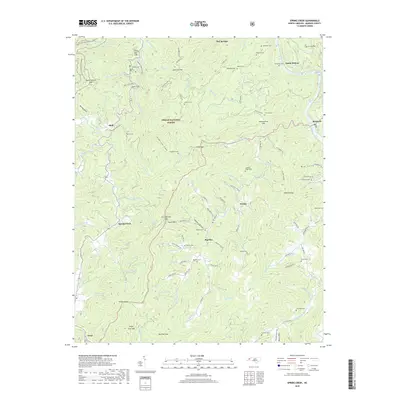
2019 Map of Spring Creek
USGS Topo · Published 2019About this map
Hot Springs and the surrounding reaches of the Pisgah National Forest define this landscape along the French Broad River. This 2019 survey captures a complex network of small mountain settlements and family cemeteries including Lunceford Cem, Treadway Cem, and Brooks Cem. The terrain is marked by prominent ridges and gaps, such as Troublesome Gap and Bearwallow Gap, which dictated the early road patterns of Madison County. The area’s geography is shaped by numerous watercourses like Big Pine Cr and Meadow Fork, which supported isolated communities like Big Pine and Worley. For those researching local lineages, the map provides precise locations for remote burying grounds like Crooked Ridge Cem and Hagen Cem, often situated near older home sites and landmarks such as House Rock or Stony Spur Cliff.
Find a feature on this map
105 named features on this map. Tap any name to fly to it.
Don’t see what you’re looking for? This feature index may not catch every label — zoom into the map to look around manually.
Map Details
Editions of this 2019 Spring Creek Map
This is the sole edition of this map. No revisions or reprints were ever made.
Other maps of this area

1894 · Asheville
USGS Topo · 1:125,000

1901 · Asheville
USGS Topo · 1:125,000

1935 · Paint Rock
USGS Topo · 1:24,000

1935 · Hot Springs
USGS Topo · 1:24,000

1935 · Spring Creek
USGS Topo · 1:24,000

1935 · Lemon Gap
USGS Topo · 1:24,000

1936 · Marshall
USGS Topo · 1:24,000

1936 · Sandymush
USGS Topo · 1:24,000

1936 · White Rock
USGS Topo · 1:24,000

1936 · Hepco
USGS Topo · 1:24,000