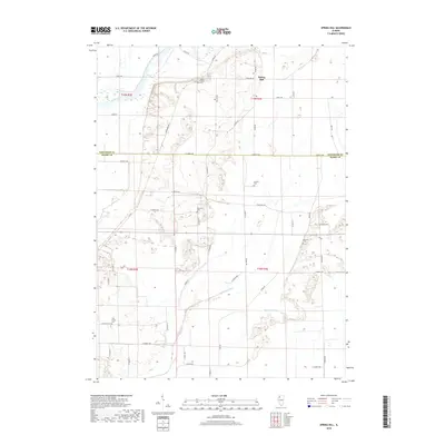
2018 Map of Spring Hill
USGS Topo · Published 2018About this map
Spring Hill sits at the northern edge of this landscape where the Rock River cuts through the corner of Whiteside Co. The terrain is defined by an intricate network of agricultural drainage, including the Big Slough Ditch and Blue Joint Ditch, reflecting a long history of water management to support the fertile bottomlands straddling the border with Henry Co. Genealogists will find a wealth of local landmarks, as the map identifies numerous small burial grounds dispersed across the rural townships. From the Sharon Church Cem and adjacent Sharon Church in the north to the Pink Prairie Cem in the southwest, these sites offer specific points of interest for family history research. The layout of rural roads, such as Ridge Rd and Town Hall Rd, follows the section lines of the Public Land Survey System, anchoring the small settlements and homesteads of this Illinois prairie region.
Find a feature on this map
53 named features on this map. Tap any name to fly to it.
Don’t see what you’re looking for? This feature index may not catch every label — zoom into the map to look around manually.
Map Details
Editions of this 2018 Spring Hill Map
This is the sole edition of this map. No revisions or reprints were ever made.
Other maps of this area

1899 · Clinton
USGS Topo · 1:125,000

1929 · Annawan
USGS Topo · 1:62,500

1932 · Prophetstown
USGS Topo · 1:48,000

1932 · Annawan
USGS Topo · 1:62,500

1934 · Geneseo
USGS Topo · 1:62,500

1936 · Prophetstown
USGS Topo · 1:62,500

1952 · Erie
USGS Topo · 1:62,500
1953 · Geneseo
USGS Topo · 1:24,000
1953 · Atkinson
USGS Topo · 1:24,000

1958 · Davenport
USGS Topo · 1:250,000