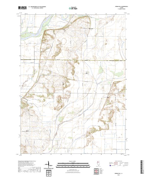
2024 Map of Spring Hill
USGS Topo · Published 2024About this map
The Rock River flows through the northwest corner of this agricultural landscape, anchoring a network of drainage features and sloughs that define the local geography. Centered on the settlement of Spring Hill, the area is characterized by an extensive grid of section-line roads and several early burial grounds that serve as significant markers for local genealogy. The placement of Sharon Church Cem, Loraine Cem, and Bowman Cem suggests the distribution of early rural congregations and homesteads across the Henry and Whiteside county line.
Find a feature on this map
52 named features on this map. Tap any name to fly to it.
Don’t see what you’re looking for? This feature index may not catch every label — zoom into the map to look around manually.
Map Details
Editions of this 2024 Spring Hill Map
This is the sole edition of this map. No revisions or reprints were ever made.
Other maps of this area

1899 · Clinton
USGS Topo · 1:125,000

1929 · Annawan
USGS Topo · 1:62,500

1932 · Prophetstown
USGS Topo · 1:48,000

1932 · Annawan
USGS Topo · 1:62,500

1934 · Geneseo
USGS Topo · 1:62,500

1936 · Prophetstown
USGS Topo · 1:62,500

1952 · Erie
USGS Topo · 1:62,500
1953 · Geneseo
USGS Topo · 1:24,000
1953 · Atkinson
USGS Topo · 1:24,000

1958 · Davenport
USGS Topo · 1:250,000