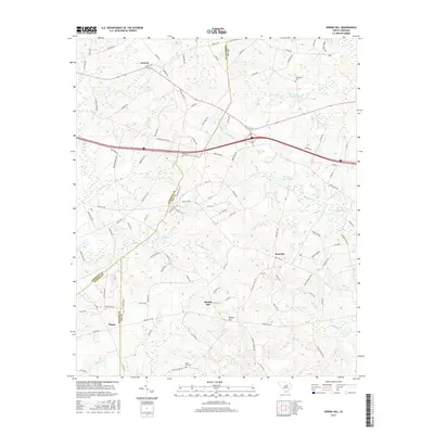
2017 Map of Spring Hill
USGS Topo · Published 2017About this map
Antioch and the surrounding rural landscapes of Kershaw, Lee, and Sumter counties are defined by a network of creeks and man-made millponds. This 2017 survey illustrates the agricultural and residential character of the region, where communities like Pisgah, Spring Hill, and Red Hill are linked by a dense grid of secondary roads and local routes such as Seegars Mill Rd and Lucknow Rd. The topography is shaped by the drainage patterns of Swift Cr and Little Swift Cr, which feed into local impoundments like Shiver Millpond and Corbitts Millpond. These water features, alongside family-named landmarks like McLeods Upper Pond and Windi Knoll Lake, reflect the historical reliance on local waterways for industry and recreation in this part of the South Carolina sandhills.
Find a feature on this map
109 named features on this map. Tap any name to fly to it.
Don’t see what you’re looking for? This feature index may not catch every label — zoom into the map to look around manually.
Map Details
Editions of this 2017 Spring Hill Map
This is the sole edition of this map. No revisions or reprints were ever made.
Other maps of this area

1935 · Camden
USGS Topo · 1:48,000

1938 · Camden
USGS Topo · 1:62,500

1938 · Hagood
USGS Topo · 1:62,500

1941 · Spartanburg
USGS Topo · 1:250,000

1942 · Camden
USGS Topo · 1:125,000

1953 · Camden South
USGS Topo · 1:24,000

1953 · Rembert
USGS Topo · 1:24,000

1953 · Spartanburg
USGS Topo · 1:250,000

1957 · Ashwood
USGS Topo · 1:62,500

1960 · Spartanburg
USGS Topo · 1:250,000