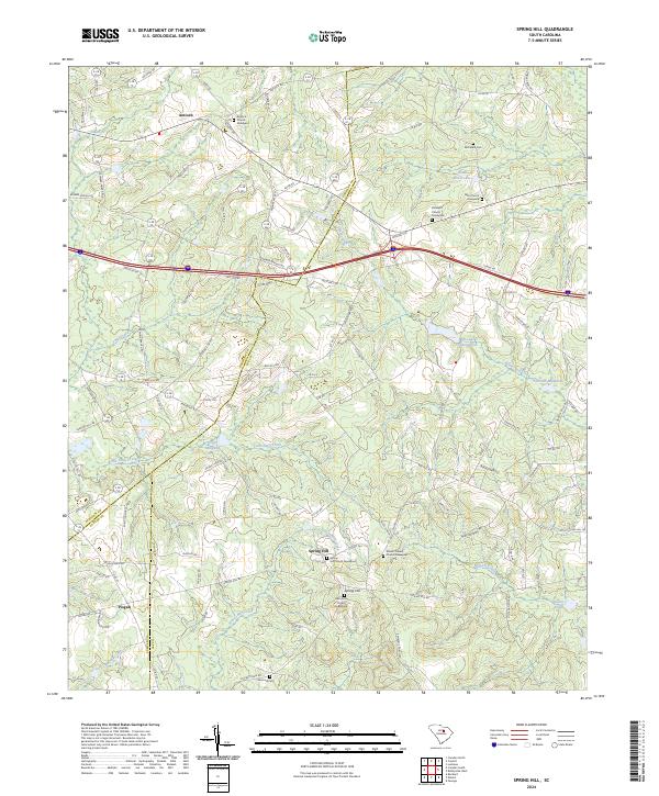
2024 Map of Spring Hill
USGS Topo · Published 2024About this map
Antioch and the surrounding rural landscapes of Lee, Kershaw, and Sumter Counties are defined by a network of historic congregations and family burial grounds. The community of Spring Hill serves as a local focal point where Spring Hill Church Graveyard and Mount Calvary Church sit near the headwaters of Bracey Mill Creek. The terrain is deeply carved by the drainage systems of Swift Creek and Little Swift Creek, which historically supported local industry as evidenced by Shiver Millpond and Gorbetts Millpond. This contemporary survey preserves the locations of numerous spiritual landmarks, including Saint John Church and Faith Church, alongside secluded cemeteries like Sand Hill Cem and McCaskill Cem. The map illustrates how modern road networks like the Interstate 20 corridor overlay an older settlement pattern rooted in the region's agricultural and hydrologic history.
Find a feature on this map
117 named features on this map. Tap any name to fly to it.
Don’t see what you’re looking for? This feature index may not catch every label — zoom into the map to look around manually.
Map Details
Editions of this 2024 Spring Hill Map
This is the sole edition of this map. No revisions or reprints were ever made.
Other maps of this area

1935 · Camden
USGS Topo · 1:48,000

1938 · Camden
USGS Topo · 1:62,500

1938 · Hagood
USGS Topo · 1:62,500

1941 · Spartanburg
USGS Topo · 1:250,000

1942 · Camden
USGS Topo · 1:125,000

1953 · Camden South
USGS Topo · 1:24,000

1953 · Rembert
USGS Topo · 1:24,000

1953 · Spartanburg
USGS Topo · 1:250,000

1957 · Ashwood
USGS Topo · 1:62,500

1960 · Spartanburg
USGS Topo · 1:250,000