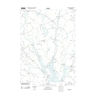
2012 Map of Spring Hill
USGS Topo · Published 2012About this map
The Fenton River and Mount Hope River carve parallel paths through this corner of eastern Connecticut, anchoring a landscape defined by small mill settlements and early post offices. Communities like Gurleyville, Atwoodville, and Chaffeeville are spaced along these watercourses, illustrating the historical reliance on river power for local industry. The terrain is marked by prominent ridges including Wormwood Hill and Knowlton Hill, while the southeastern corner is dominated by the sprawling wetlands around the Natchaug River and Mansfield Hollow.
Find a feature on this map
178 named features on this map. Tap any name to fly to it.
Don’t see what you’re looking for? This feature index may not catch every label — zoom into the map to look around manually.
Map Details
Editions of this 2012 Spring Hill Map
This is the sole edition of this map. No revisions or reprints were ever made.
Other maps of this area

1892 · Woodstock
USGS Topo · 1:62,500

1892 · Tolland
USGS Topo · 1:62,500

1892 · Norwich
USGS Topo · 1:62,500

1892 · Gilead
USGS Topo · 1:62,500

1921 · Tolland
USGS Topo · 1:62,500

1921 · Woodstock
USGS Topo · 1:62,500

1944 · South Coventry
USGS Topo · 1:31,680
1944 · Hampton
USGS Topo · 1:31,680

1944 · Columbia
USGS Topo · 1:31,680
1945 · Spring Hill
USGS Topo · 1:31,680