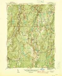
1944 Map of Hampton
USGS Topo · Published 1944About this map
Natchaug State Forest dominates the northern reaches of this mid-century landscape, where the Natchaug River and Bigelow Brook converge near Phoenixville. The village of Hampton serves as a central hub, connected to the wider region by the New York New Haven and Hartford railroad, which supported local stations like Hampton Sta and nearby Elliotts. This era shows a community defined by its rural intersections, such as Clarks Corner and Stetson Corner, and its preserved history at the Nathaniel Lyon Memorial.
Find a feature on this map
65 named features on this map. Tap any name to fly to it.
Don’t see what you’re looking for? This feature index may not catch every label — zoom into the map to look around manually.
Map Details
Editions of this 1944 Hampton Map
2 editions found
Other maps of this area

1889 · Putnam
USGS Topo · 1:62,500

1889 · Moosup
USGS Topo · 1:62,500

1892 · Woodstock
USGS Topo · 1:62,500

1892 · Norwich
USGS Topo · 1:62,500

1893 · Putnam
USGS Topo · 1:62,500

1893 · Moosup
USGS Topo · 1:62,500

1919 · Putnam
USGS Topo · 1:62,500

1920 · Moosup
USGS Topo · 1:62,500

1921 · Woodstock
USGS Topo · 1:62,500

1943 · Plainfield
USGS Topo · 1:31,680