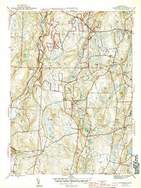
1944 Map of Hampton
USGS Topo · Published 1944About this map
Natchaug State Forest dominates the upper reaches of this mid-century survey, where the Natchaug River carves a path through eastern Connecticut. The landscape is a network of small upland settlements and family-named landmarks, such as Lyon Hill and Paine Hill, alongside the Nathaniel Lyon Memorial. The economy and transit of the era are defined by the New York New Haven and Hartford railroad, which links the communities of Rawson, Elliotts, and the Hampton Station stop. Local history is deeply etched into the terrain through several burial grounds, including North Cem and Litchfield Cem. Water resources are abundant, ranging from the large Hampton Reservoir to smaller ponds like Bigelow Pond and Pine Acres Lake, illustrating the rural and agricultural character of Windham County before the expansion of modern suburban infrastructure.
Find a feature on this map
63 named features on this map. Tap any name to fly to it.
Don’t see what you’re looking for? This feature index may not catch every label — zoom into the map to look around manually.
Map Details
Editions of this 1944 Hampton Map
2 editions found
Other maps of this area

1889 · Putnam
USGS Topo · 1:62,500

1889 · Moosup
USGS Topo · 1:62,500

1892 · Woodstock
USGS Topo · 1:62,500

1892 · Norwich
USGS Topo · 1:62,500

1893 · Putnam
USGS Topo · 1:62,500

1893 · Moosup
USGS Topo · 1:62,500

1919 · Putnam
USGS Topo · 1:62,500

1920 · Moosup
USGS Topo · 1:62,500

1921 · Woodstock
USGS Topo · 1:62,500

1943 · Plainfield
USGS Topo · 1:31,680