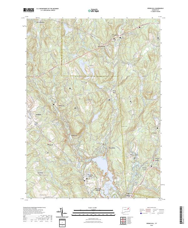
2024 Map of Spring Hill
USGS Topo · Published 2024About this map
The University of Connecticut at Storrs anchor the western portion of this landscape, where the academic grounds meet a patchwork of river valleys and historical hamlets. The Fenton River and Mount Hope River flow southward through the terrain, eventually feeding into the large Mansfield Hollow Lake. Along these waterways, small settlements like Gurleyville, Chaffeeville, and Atwoodville reflect the region's long-established rural layout. The map also highlights the complex local history of the Mansfield Center area, including the Olde Mansfield Center Cem.
Find a feature on this map
84 named features on this map. Tap any name to fly to it.
Don’t see what you’re looking for? This feature index may not catch every label — zoom into the map to look around manually.
Map Details
Editions of this 2024 Spring Hill Map
This is the sole edition of this map. No revisions or reprints were ever made.
Other maps of this area

1892 · Woodstock
USGS Topo · 1:62,500

1892 · Tolland
USGS Topo · 1:62,500

1892 · Norwich
USGS Topo · 1:62,500

1892 · Gilead
USGS Topo · 1:62,500

1921 · Tolland
USGS Topo · 1:62,500

1921 · Woodstock
USGS Topo · 1:62,500

1944 · South Coventry
USGS Topo · 1:31,680
1944 · Hampton
USGS Topo · 1:31,680

1944 · Columbia
USGS Topo · 1:31,680
1945 · Spring Hill
USGS Topo · 1:31,680