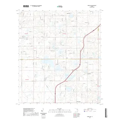
2021 Map of Spring Lake
USGS Topo · Published 2021About this map
Spring Lake and the northern reaches of Pasco County are defined by an intricate network of sinkhole lakes and karst topography typical of this Florida uplands region. The landscape transitions from the higher elevations of Hickory Hill down to a dense collection of named water bodies, including Hancock Lake, Lake Iola, and Jessamine Lake. These basins historically supported citrus groves and small-scale agriculture, as evidenced by local roads such as Orange Grove Rd and the proximity of the Jessamine settlement. Cultural sites are scattered across the terrain, with family and community legacy preserved at Johnson Cem, Twin Lakes Cem, and the Townsend House Cem near the shores of Middle Lake. To the south, the community of Saint Joseph sits near the headwaters of Cypress Cr, illustrating the long-standing connection between local hydrology and rural settlement patterns in Hernando and Pasco Counties.
Find a feature on this map
133 named features on this map. Tap any name to fly to it.
Don’t see what you’re looking for? This feature index may not catch every label — zoom into the map to look around manually.
Map Details
Editions of this 2021 Spring Lake Map
This is the sole edition of this map. No revisions or reprints were ever made.
Other maps of this area

1954 · Spring Lake
USGS Topo · 1:24,000

1954 · Ehren
USGS Topo · 1:24,000

1954 · San Antonio
USGS Topo · 1:24,000

1954 · Brooksville
USGS Topo · 1:24,000

1954 · Masaryktown
USGS Topo · 1:24,000

1954 · Brooksville SE
USGS Topo · 1:24,000

1955 · Plant City
USGS Topo · 1:250,000

1958 · Plant City
USGS Topo · 1:250,000

1958 · Saint Catherine
USGS Topo · 1:24,000

1959 · Plant City
USGS Topo · 1:250,000