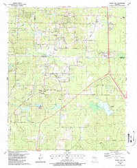
1987 Map of Spring Lake
USGS Topo · Published 1987About this map
The boundary between Saline and Pulaski counties cuts across this late 1980s landscape, where rural communities like East End and Parkers maintain a strong social infrastructure of local institutions. Dozens of churches, including Center Ridge Ch, Freedom Ch, and New Life Ch, are distributed alongside significant landmarks like the Carmelite Novitiate. Educational history is represented by the East End School and Landmark Sch, while family history is preserved at Upchurch Cem and Hicks Cem.
Find a feature on this map
66 named features on this map. Tap any name to fly to it.
Don’t see what you’re looking for? This feature index may not catch every label — zoom into the map to look around manually.
Map Details
Editions of this 1987 Spring Lake Map
This is the sole edition of this map. No revisions or reprints were ever made.
Other maps of this area

1891 · Little Rock
USGS Topo · 1:125,000

1893 · Little Rock
USGS Topo · 1:125,000

1932 · Pastoria
USGS Topo · 1:62,500

1935 · Little Rock
USGS Topo · 1:24,000

1935 · Sweet Home
USGS Topo · 1:24,000

1935 · Alexander
USGS Topo · 1:48,000

1935 · Pastoria
USGS Topo · 1:62,500

1940 · Woodson
USGS Topo · 1:31,680

1941 · Alexander
USGS Topo · 1:62,500

1944 · Alexander
USGS Topo · 1:31,680