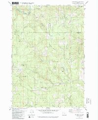
1979 Map of Springer Mtn
USGS Topo · Published 1980About this map
The Nestucca River winds through the northern reaches of this territory, where the Tillamook State Forest meets the Siuslaw National Forest. The landscape is defined by the high ridges of the Northern Oregon Coast Range, including Springer Mountain, Bell Mountain, and Pumpkinseed Mtn. This 1970s survey illustrates a region heavily focused on timber and resource extraction, evidenced by the numerous quarries, borrow pits, and a network of logging access routes like the Bible Creek Access Road and Niagara Road. Small recreational and work outposts such as Camp Cooper and the Rocky Bend Campground provide the only significant human footprints amidst the dense drainages of Willamina Creek and Bible Creek. These waterways and the steep topography of Big Mountain and Thune Mtn reflect the challenging environment of the Yamhill and Tillamook county line.
Find a feature on this map
46 named features on this map. Tap any name to fly to it.
Don’t see what you’re looking for? This feature index may not catch every label — zoom into the map to look around manually.
Map Details
Editions of this 1979 Springer Mtn Map
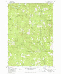
2 editions found
Other maps of this area

1942 · Ginger Peak
USGS Topo · 1:62,500

1942 · Sheridan
USGS Topo · 1:62,500

1942 · Spirit Mtn
USGS Topo · 1:62,500

1942 · Fairdale
USGS Topo · 1:62,500

1948 · Vancouver
USGS Topo · 1:250,000

1950 · Vancouver
USGS Topo · 1:250,000

1950 · Vancouver
USGS Topo · 1:250,000

1955 · Blaine
USGS Topo · 1:62,500

1955 · Fairdale
USGS Topo · 1:62,500

1955 · Grand Ronde
USGS Topo · 1:62,500