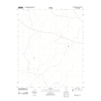
2011 Map of Springerville NW
USGS Topo · Published 2011About this map
Carnero Creek meanders through this high-altitude landscape of eastern Arizona, shaping the distribution of isolated water sources and small-scale developments in the years following the turn of the twenty-first century. The area is defined by its hydrology, featuring localized landmarks such as Cheney Lake and a series of named water points including Schuster Spring, Corral Spring, and Gibbons Spring. These features suggest a history of livestock management and early settlement patterns typical of the region's ranching heritage. Green Spot appears as the primary named locality, situated north of the creek. Connectivity across this portion of Apache County is maintained by Highway 60, which cuts through the northern half of the quadrangle, and County Road 4385, providing access to this high-country terrain.
Find a feature on this map
8 named features on this map. Tap any name to fly to it.
Don’t see what you’re looking for? This feature index may not catch every label — zoom into the map to look around manually.
Map Details
Editions of this 2011 Springerville NW Map
This is the sole edition of this map. No revisions or reprints were ever made.
Other maps of this area

1886 · St Johns
USGS Topo · 1:250,000

1892 · St Johns
USGS Topo · 1:250,000

1954 · Saint Johns
USGS Topo · 1:250,000

1957 · Saint Johns
USGS Topo · 1:250,000

1958 · Saint Johns
USGS Topo · 1:250,000

1962 · Saint Johns
USGS Topo · 1:250,000

1968 · Springerville NW
USGS Topo · 1:24,000

1969 · Whiting Knoll
USGS Topo · 1:24,000
1969 · Greer
USGS Topo · 1:24,000
1969 · Eagar
USGS Topo · 1:24,000