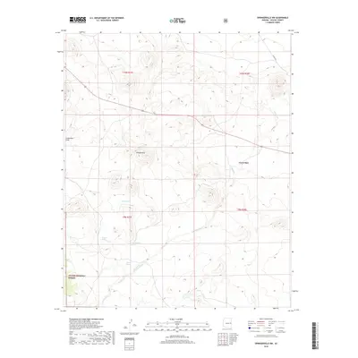
2018 Map of Springerville NW
USGS Topo · Published 2018About this map
Green Spot serves as a lone named focal point within this high-elevation landscape in eastern Arizona. The terrain is defined by a series of drainages and seasonal water sources that have historically supported ranching and forestry in the region. Carnero Creek meanders through the southern half of the map, fed by several named springs including Schuster Spring, Corral Spring, and Gibbons Spring. These reliable water points are critical landmarks in the dry environment, often indicating historical grazing sites or early camps.
Find a feature on this map
16 named features on this map. Tap any name to fly to it.
Don’t see what you’re looking for? This feature index may not catch every label — zoom into the map to look around manually.
Map Details
Editions of this 2018 Springerville NW Map
This is the sole edition of this map. No revisions or reprints were ever made.
Other maps of this area

1886 · St Johns
USGS Topo · 1:250,000

1892 · St Johns
USGS Topo · 1:250,000

1954 · Saint Johns
USGS Topo · 1:250,000

1957 · Saint Johns
USGS Topo · 1:250,000

1958 · Saint Johns
USGS Topo · 1:250,000

1962 · Saint Johns
USGS Topo · 1:250,000

1968 · Springerville NW
USGS Topo · 1:24,000

1969 · Whiting Knoll
USGS Topo · 1:24,000
1969 · Greer
USGS Topo · 1:24,000
1969 · Eagar
USGS Topo · 1:24,000