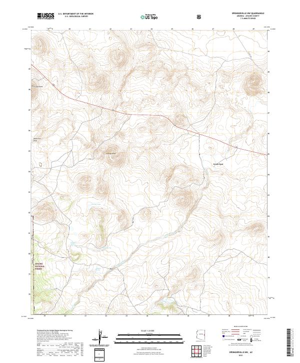
2021 Map of Springerville NW
USGS Topo · Published 2021About this map
Apache National Forest lands dominate the southwestern portion of this high-elevation landscape in Apache County. This 2021 survey illustrates a terrain defined by volcanic features and drainage patterns, most notably the prominent rise of Cerro Quemado in the northwest. Water resources are critical in this arid environment, marked by several named water sources such as Schuster Spring, Corral Spring, and Gibbons Spring. These springs and the ephemeral Carnero Creek have historically dictated movement and land use across the high plateau.
Find a feature on this map
16 named features on this map. Tap any name to fly to it.
Don’t see what you’re looking for? This feature index may not catch every label — zoom into the map to look around manually.
Map Details
Editions of this 2021 Springerville NW Map
This is the sole edition of this map. No revisions or reprints were ever made.
Other maps of this area

1886 · St Johns
USGS Topo · 1:250,000

1892 · St Johns
USGS Topo · 1:250,000

1954 · Saint Johns
USGS Topo · 1:250,000

1957 · Saint Johns
USGS Topo · 1:250,000

1958 · Saint Johns
USGS Topo · 1:250,000

1962 · Saint Johns
USGS Topo · 1:250,000

1968 · Springerville NW
USGS Topo · 1:24,000

1969 · Whiting Knoll
USGS Topo · 1:24,000
1969 · Greer
USGS Topo · 1:24,000
1969 · Eagar
USGS Topo · 1:24,000