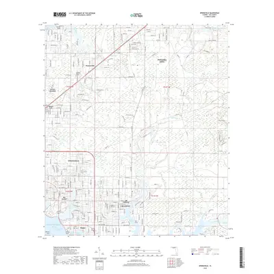
2018 Map of Springfield
USGS Topo · Published 2018About this map
East Bay and the complex inlets of the Gulf of Mexico dominate this modern landscape, where the Intracoastal Waterway cuts through the coastal terrain. The map captures the dense residential and industrial expansion of Springfield, Callaway, and Parker, showing the intricate web of street-level detail from E 15th St down to Parker Point. Local history is preserved in the location of Old Callaway and the Evergreen Memorial Gardens cemetery, while the industrial transit roots of the region are marked by the Bay Line RR route. Further inland, the map transitions into the wetlands and tidal systems of California Swamp and Sweetwater Branch, illustrating how the coastal environment continues to shape the footprint of Panama City and its neighbors. The surveying provides a precise look at the various bayous, including Laird Bayou and Mill Bayou, which serve as the primary geographical anchors for these waterfront communities.
Find a feature on this map
119 named features on this map. Tap any name to fly to it.
Don’t see what you’re looking for? This feature index may not catch every label — zoom into the map to look around manually.
Map Details
Editions of this 2018 Springfield Map
This is the sole edition of this map. No revisions or reprints were ever made.
Other maps of this area

1943 · Beacon Beach
USGS Topo · 1:31,680

1943 · Panama City
USGS Topo · 1:31,680

1943 · Southport
USGS Topo · 1:24,000

1944 · Southport
USGS Topo · 1:24,000

1944 · Long Point
USGS Topo · 1:31,680

1944 · Bayhead
USGS Topo · 1:24,000

1945 · Youngstown
USGS Topo · 1:31,680

1945 · Bayhead
USGS Topo · 1:31,680

1945 · Allanton
USGS Topo · 1:31,680

1945 · North Of Allanton
USGS Topo · 1:31,680