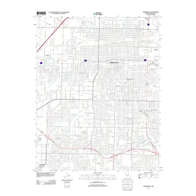
2011 Map of Springfield
USGS Topo · Published 2011About this map
Springfield's dense urban grid is defined by a complex network of waterways, including Jordan Creek and the many branches of Wilsons Creek. This 2011 survey documents the city during a period of established growth, highlighting the concentration of medical and educational institutions such as the US Medical Ctr and Southwest Missouri State University. The cartography reveals a landscape where modern commercial hubs like the Battlefield Mall coexist with numerous burial grounds, including the Springfield National Cemetery and Saint Marys Cemetery. Along the eastern edge, the Chadwick Junction and Downtown Airport mark key transport and infrastructure points. The natural topography is visible in the southwestern corner near Battlefield, where features like the Oval Sink indicate the underlying karst geology of the Greene County region.
Find a feature on this map
104 named features on this map. Tap any name to fly to it.
Don’t see what you’re looking for? This feature index may not catch every label — zoom into the map to look around manually.
Map Details
Editions of this 2011 Springfield Map
This is the sole edition of this map. No revisions or reprints were ever made.
Other maps of this area

1884 · Springfield
USGS Topo · 1:125,000

1886 · Springfield
USGS Topo · 1:125,000

1935 · Springfield
USGS Topo · 1:24,000

1936 · Brookline
USGS Topo · 1:24,000

1937 · Galloway
USGS Topo · 1:24,000

1937 · Ozark
USGS Topo · 1:48,000

1943 · Ozark
USGS Topo · 1:62,500

1945 · Ozark
USGS Topo · 1:62,500

1946 · Bassville
USGS Topo · 1:24,000

1947 · Strafford
USGS Topo · 1:62,500