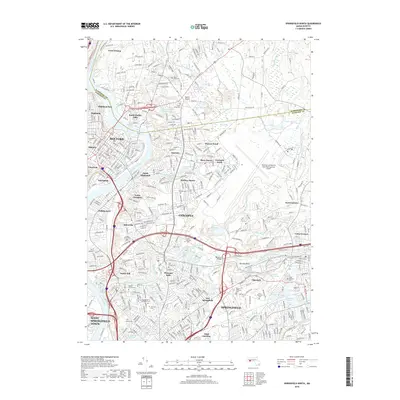
2018 Map of Springfield North
USGS Topo · Published 2018About this map
The Connecticut River and Chicopee River serve as the industrial and geographic anchors of this 2018 survey, carving through a landscape defined by dense urban development and historic water management. In Chicopee, the legacy of the nineteenth-century industrial boom is visible in the layout of neighborhoods like Chicopee Falls and Willimansett, while the sprawling footprint of the Westover Air Reserve Base dominates the eastern plateau.
Find a feature on this map
81 named features on this map. Tap any name to fly to it.
Don’t see what you’re looking for? This feature index may not catch every label — zoom into the map to look around manually.
Map Details
Editions of this 2018 Springfield North Map
This is the sole edition of this map. No revisions or reprints were ever made.
Other maps of this area

1885 · Northampton
USGS Topo · 1:62,500

1886 · Springfield
USGS Topo · 1:62,500

1886 · Northampton
USGS Topo · 1:62,500

1887 · Palmer
USGS Topo · 1:62,500

1887 · Belchertown
USGS Topo · 1:62,500

1889 · Springfield
USGS Topo · 1:62,500

1889 · Palmer
USGS Topo · 1:62,500

1890 · Belchertown
USGS Topo · 1:62,500

1891 · Northampton
USGS Topo · 1:62,500

1893 · Northampton
USGS Topo · 1:62,500