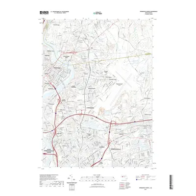
2021 Map of Springfield North
USGS Topo · Published 2021About this map
Holyoke and Chicopee dominate this landscape where the Connecticut River and Chicopee River meet, reflecting a dense urban and industrial heritage. The mapping detail shows a complex network of neighborhoods like Aldenville, Willimansett, and Chicopee Falls, interspersed with numerous memorial sites such as Polish National Cem and Saint Patricks Cem. This 2021 study captures the modern footprints of historic industry at Fiberloid and the expansive infrastructure of the Westover Air Reserve Base. Educational and recreational spaces are prominently featured, from the College of Our Lady of the Elms to the Holyoke Canalwalk Trl. The presence of Athol Junction and numerous reservoirs like Leaping Well Reservoir and Chicopee Reservoir highlights the region's managed water systems and rail history, providing a detailed record of the interconnected communities north of Springfield.
Find a feature on this map
85 named features on this map. Tap any name to fly to it.
Don’t see what you’re looking for? This feature index may not catch every label — zoom into the map to look around manually.
Map Details
Editions of this 2021 Springfield North Map
This is the sole edition of this map. No revisions or reprints were ever made.
Other maps of this area

1885 · Northampton
USGS Topo · 1:62,500

1886 · Springfield
USGS Topo · 1:62,500

1886 · Northampton
USGS Topo · 1:62,500

1887 · Palmer
USGS Topo · 1:62,500

1887 · Belchertown
USGS Topo · 1:62,500

1889 · Springfield
USGS Topo · 1:62,500

1889 · Palmer
USGS Topo · 1:62,500

1890 · Belchertown
USGS Topo · 1:62,500

1891 · Northampton
USGS Topo · 1:62,500

1893 · Northampton
USGS Topo · 1:62,500