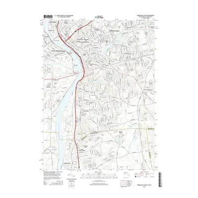
2015 Map of Springfield South
USGS Topo · Published 2015About this map
The Connecticut River serves as the central artery for this densely populated corridor at the Massachusetts-Connecticut border. In Springfield, the Springfield Armory National Historic Site stands as a focal point of the urban landscape, surrounded by established neighborhoods like McKnight and Bay, Old Hill, and Liberty Heights. The map documents a complex network of academic and civic institutions, including Springfield College and American International College, alongside numerous sacred spaces such as Springfield Cem and Saint Michaels Cem. South of the city, the landscape shifts toward the expansive Forest Park and the suburban reaches of Longmeadow and East Longmeadow. Across the river, the residential and industrial grids of West Springfield and Agawam are clearly delineated, while the southern margin captures the transition into Hartford County with the settlements of Thompsonville and North Thompsonville.
Find a feature on this map
71 named features on this map. Tap any name to fly to it.
Don’t see what you’re looking for? This feature index may not catch every label — zoom into the map to look around manually.
Map Details
Editions of this 2015 Springfield South Map
This is the sole edition of this map. No revisions or reprints were ever made.
Other maps of this area

1886 · Springfield
USGS Topo · 1:62,500

1887 · Palmer
USGS Topo · 1:62,500

1889 · Springfield
USGS Topo · 1:62,500

1889 · Palmer
USGS Topo · 1:62,500

1892 · Hartford
USGS Topo · 1:62,500

1892 · Tolland
USGS Topo · 1:62,500

1893 · Springfield
USGS Topo · 1:62,500

1893 · Palmer
USGS Topo · 1:62,500

1895 · Springfield
USGS Topo · 1:62,500

1896 · Holyoke
USGS Topo · 1:125,000