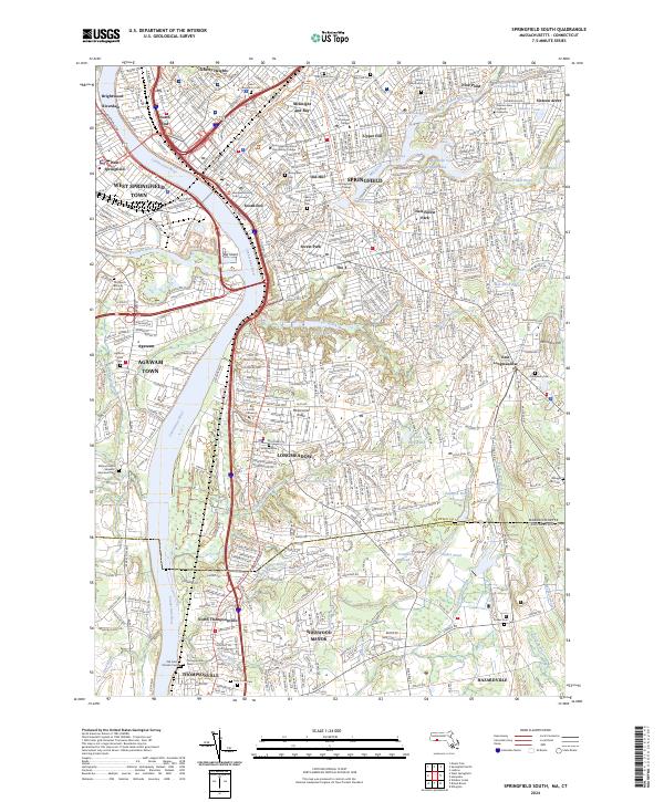
2024 Map of Springfield South
USGS Topo · Published 2024About this map
The Connecticut River and its major tributaries, including the Westfield River and Mill River, define the urban and suburban landscape south of Springfield. This contemporary survey illustrates a densely settled corridor spanning from Brightwood and Liberty Heights down through the neighborhoods of Old Hill, The X, and Forest Park. The presence of several established higher education institutions like American International College and Springfield Technical Community College reflects the region's enduring role as a center for education and government, anchored by the Hampden County Court House.
Find a feature on this map
85 named features on this map. Tap any name to fly to it.
Don’t see what you’re looking for? This feature index may not catch every label — zoom into the map to look around manually.
Map Details
Editions of this 2024 Springfield South Map
This is the sole edition of this map. No revisions or reprints were ever made.
Other maps of this area

1886 · Springfield
USGS Topo · 1:62,500

1887 · Palmer
USGS Topo · 1:62,500

1889 · Springfield
USGS Topo · 1:62,500

1889 · Palmer
USGS Topo · 1:62,500

1892 · Hartford
USGS Topo · 1:62,500

1892 · Tolland
USGS Topo · 1:62,500

1893 · Springfield
USGS Topo · 1:62,500

1893 · Palmer
USGS Topo · 1:62,500

1895 · Springfield
USGS Topo · 1:62,500

1896 · Holyoke
USGS Topo · 1:125,000