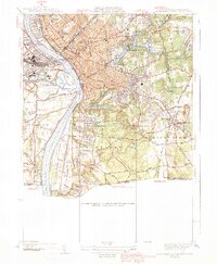
1939 Map of Springfield South
USGS Topo · Published 1939About this map
The Connecticut River dominates this pre-war landscape, serving as the central axis for the industrial and residential growth of Springfield and its neighboring communities. This 1939 edition highlights a complex urban infrastructure defined by major rail lines like the Boston and Albany RR and the Boston and Maine RR, which converge at Union Sta. The industrial character of the era is anchored by the prominent U S Armory and the expansive Watershops Pond, while the cultural and social life of the city is represented by Springfield College and the Exposition Grounds across the river.
Find a feature on this map
57 named features on this map. Tap any name to fly to it.
Don’t see what you’re looking for? This feature index may not catch every label — zoom into the map to look around manually.
Map Details
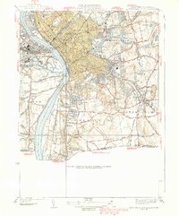
Editions of this 1939 Springfield South Map
2 editions found
Other maps of this area

1886 · Springfield
USGS Topo · 1:62,500

1887 · Palmer
USGS Topo · 1:62,500

1889 · Springfield
USGS Topo · 1:62,500

1889 · Palmer
USGS Topo · 1:62,500

1892 · Hartford
USGS Topo · 1:62,500

1892 · Tolland
USGS Topo · 1:62,500

1893 · Springfield
USGS Topo · 1:62,500

1893 · Palmer
USGS Topo · 1:62,500

1895 · Springfield
USGS Topo · 1:62,500

1896 · Holyoke
USGS Topo · 1:125,000