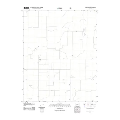
2011 Map of Springfield SW
USGS Topo · Published 2011About this map
Liberty sits at the heart of this high plains landscape in Baca County, where the settlement pattern is defined by a rigid grid of rural roads. The area is characterized by drainage features like Lone Rock Draw, which cuts diagonally across the northern and western sections of the terrain. Land use is deeply tied to the township-and-range system, with secondary routes such as Co RD V, Co RD 21, and Co RD 23 providing the primary infrastructure for the region's ranching or agricultural operations. Water access is critical in this dry environment, evidenced by the inclusion of Little Bankiter Well as a named landmark. This survey documents the persistent, sparse settlement of southeastern Colorado, where the vastness of the open range is punctuated only by these isolated sites and the essential network of county-maintained roads.
Find a feature on this map
13 named features on this map. Tap any name to fly to it.
Don’t see what you’re looking for? This feature index may not catch every label — zoom into the map to look around manually.
Map Details
Editions of this 2011 Springfield SW Map
This is the sole edition of this map. No revisions or reprints were ever made.
Other maps of this area

1891 · Springfield
USGS Topo · 1:125,000

1893 · Springfield
USGS Topo · 1:125,000

1955 · La Junta
USGS Topo · 1:250,000

1958 · La Junta
USGS Topo · 1:250,000

1968 · La Junta
USGS Topo · 1:250,000

1978 · Edler
USGS Topo · 1:24,000

1978 · Pritchett
USGS Topo · 1:24,000

1978 · Springfield SW
USGS Topo · 1:24,000

1978 · Campo NE
USGS Topo · 1:24,000
1978 · Harbord
USGS Topo · 1:24,000