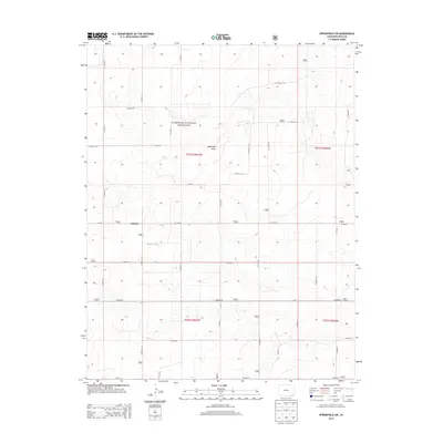
2013 Map of Springfield SW
USGS Topo · Published 2013About this map
Comanche National Grassland encompasses a large portion of this high plains landscape in southern Baca County, characterized by a structured grid of rural transport and wide drainage features. The settlement of Liberty sits at the intersection of Co Road 19 and Co Road Y, serving as a central point in an area defined by large-scale land management and agriculture. The terrain is marked by gentle undulations and the significant Lone Rock Draw, which cuts across the central townships. The map illustrates the late twentieth-century development of the region's infrastructure, where named section lines like Co Road AA and Co Road 25 provide the primary framework for local travel through these expansive grasslands.
Find a feature on this map
28 named features on this map. Tap any name to fly to it.
Don’t see what you’re looking for? This feature index may not catch every label — zoom into the map to look around manually.
Map Details
Editions of this 2013 Springfield SW Map
This is the sole edition of this map. No revisions or reprints were ever made.
Other maps of this area

1891 · Springfield
USGS Topo · 1:125,000

1893 · Springfield
USGS Topo · 1:125,000

1955 · La Junta
USGS Topo · 1:250,000

1958 · La Junta
USGS Topo · 1:250,000

1968 · La Junta
USGS Topo · 1:250,000

1978 · Edler
USGS Topo · 1:24,000

1978 · Pritchett
USGS Topo · 1:24,000

1978 · Springfield SW
USGS Topo · 1:24,000

1978 · Campo NE
USGS Topo · 1:24,000
1978 · Harbord
USGS Topo · 1:24,000