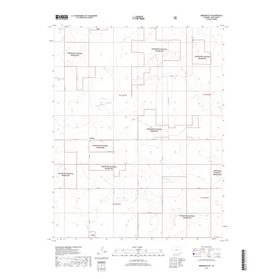
2019 Map of Springfield SW
USGS Topo · Published 2019About this map
Liberty sits at a remote crossroads in the high plains of Baca County, surrounded by the wide open stretches of the Comanche National Grassland. The landscape is defined by the ephemeral Lone Rock Draw, which snakes through the center of the sheet, carving subtle relief into the terrain. This 2019 survey illustrates the persistent grid of the Public Land Survey System, with township boundaries like t31s r47w and t32s r47w anchoring the vast pastoral holdings. A network of county roads, including Co RD Y and Co RD 21, provides the primary infrastructure for this ranching and conservation corridor, where the Cng abbreviation marks federal management areas amidst private sections.
Find a feature on this map
24 named features on this map. Tap any name to fly to it.
Don’t see what you’re looking for? This feature index may not catch every label — zoom into the map to look around manually.
Map Details
Editions of this 2019 Springfield SW Map
This is the sole edition of this map. No revisions or reprints were ever made.
Other maps of this area

1891 · Springfield
USGS Topo · 1:125,000

1893 · Springfield
USGS Topo · 1:125,000

1955 · La Junta
USGS Topo · 1:250,000

1958 · La Junta
USGS Topo · 1:250,000

1968 · La Junta
USGS Topo · 1:250,000

1978 · Edler
USGS Topo · 1:24,000

1978 · Pritchett
USGS Topo · 1:24,000

1978 · Springfield SW
USGS Topo · 1:24,000

1978 · Campo NE
USGS Topo · 1:24,000
1978 · Harbord
USGS Topo · 1:24,000