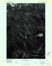
1975 Map of Springfield SW
USGS Topo · Published 1980About this map
Sysladobsis Lake dominates the eastern landscape of this 1975 aerial survey of the Maine wilderness. This orthophotomap provides a rare overhead perspective of the dense forest and wetland networks near the Penobscot border, revealing the intricate water systems that define the region. The map captures the distinctive terrain of the Todd Acre Heath, a specialized peatland environment that stands out against the surrounding timberland. Unlike traditional line-drawn maps, this photo-based document reveals the raw texture of the Maine woods, showing the winding channels and isolated clearings as they appeared during the mid-1970s before modern logging and development patterns shifted.
Find a feature on this map
2 named features on this map. Tap any name to fly to it.
Don’t see what you’re looking for? This feature index may not catch every label — zoom into the map to look around manually.
Map Details
Editions of this 1975 Springfield SW Map
This is the sole edition of this map. No revisions or reprints were ever made.
Other maps of this area

1920 · Winn
USGS Topo · 1:62,500

1931 · Springfield
USGS Topo · 1:48,000

1931 · Saponac
USGS Topo · 1:48,000

1932 · Nicatous Lake
USGS Topo · 1:48,000

1934 · Saponac
USGS Topo · 1:62,500

1934 · Nicatous Lake
USGS Topo · 1:62,500

1934 · Springfield
USGS Topo · 1:62,500

1954 · Millinocket
USGS Topo · 1:250,000

1957 · Saponac
USGS Topo · 1:62,500

1958 · Millinocket
USGS Topo · 1:250,000