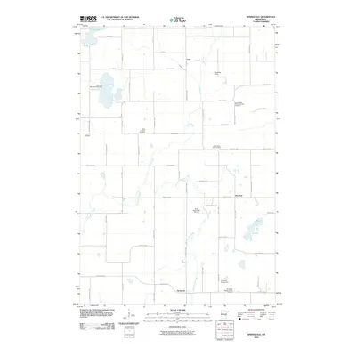
2010 Map of Springvale
USGS Topo · Published 2010About this map
Stanchfield Creek meanders through this portion of Isanti County, defining a landscape marked by small rural settlements and a significant concentration of denominational burying grounds. The southern edge of the map features the village of Springvale, where the Springvale Baptist Church Cemetery and Springvale Campground serve as local landmarks. This area preserves a high density of community-specific historical sites, including the Siloa Lutheran Cemetery and three distinct Maple Ridge cemeteries, reflecting the heritage of early settlers in the region.
Find a feature on this map
61 named features on this map. Tap any name to fly to it.
Don’t see what you’re looking for? This feature index may not catch every label — zoom into the map to look around manually.
Map Details
Editions of this 2010 Springvale Map
This is the sole edition of this map. No revisions or reprints were ever made.
Other maps of this area

1953 · Stillwater
USGS Topo · 1:250,000

1955 · Stillwater
USGS Topo · 1:250,000

1958 · Stillwater
USGS Topo · 1:250,000

1961 · Bradford
USGS Topo · 1:24,000

1961 · Cambridge
USGS Topo · 1:62,500

1961 · Brook Park
USGS Topo · 1:62,500

1961 · Springvale
USGS Topo · 1:24,000

1961 · Dalbo
USGS Topo · 1:24,000

1961 · Wyanett
USGS Topo · 1:24,000

1961 · Dalbo
USGS Topo · 1:62,500
Featured Places
- Springvale, MN
- Maple Ridge Township, MN
- Springvale Township, MN
- Grass Lake Township, MN
- Brunswick Township, MN