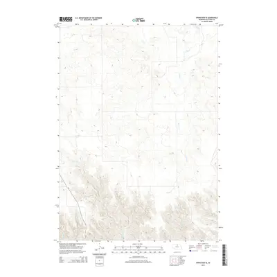
2014 Map of Springview SE
USGS Topo · Published 2014About this map
Spring Creek meanders through this section of Keya Paha County, defining a landscape of deep drainage basins and significant elevation changes. This 2014 survey captures the rural character of northern Nebraska, where the terrain is dominated by the intermittent flows of Wyman Creek, Tarbell Creek, and Beerline Creek. The primary transportation artery is Nebraska Highway 7, which cuts across the southwestern corner of the quadrangle. The map illustrates a region of sparse settlement, typical of the Sandhills transition zone, where the natural hydrology and topographical relief dictate the layout of roads and property boundaries. For those studying the environmental history of the Niobrara River watershed, the detailed contour lines provide a clear view of the complex creek systems that feed the larger river valley to the south.
Find a feature on this map
5 named features on this map. Tap any name to fly to it.
Don’t see what you’re looking for? This feature index may not catch every label — zoom into the map to look around manually.
Map Details
Editions of this 2014 Springview SE Map
This is the sole edition of this map. No revisions or reprints were ever made.
Other maps of this area

1949 · Jamison SW
USGS Topo · 1:24,000

1949 · Riverview
USGS Topo · 1:24,000

1949 · Carns
USGS Topo · 1:24,000

1950 · Bassett NW
USGS Topo · 1:24,000

1950 · Carns
USGS Topo · 1:24,000

1950 · Riverview
USGS Topo · 1:24,000

1951 · Jamison SW
USGS Topo · 1:24,000

1955 · O'Neill
USGS Topo · 1:250,000

1959 · O'Neill
USGS Topo · 1:250,000

1964 · Mills
USGS Topo · 1:24,000