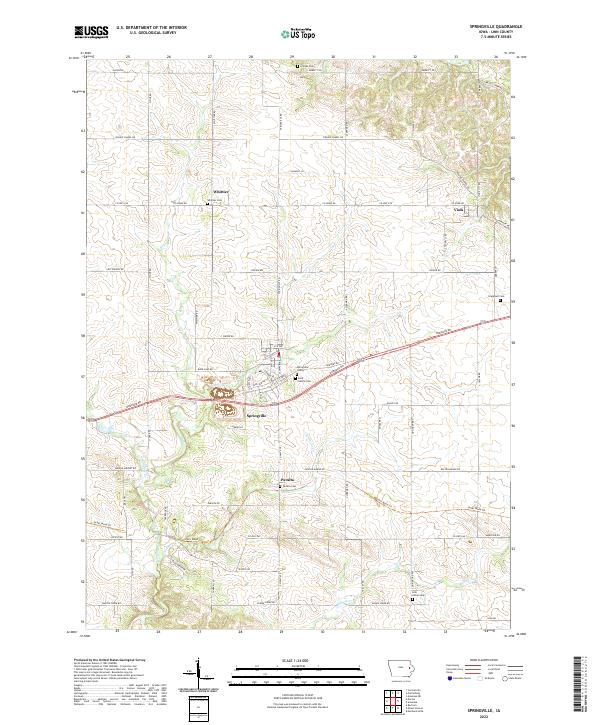
2022 Map of Springville
USGS Topo · Published 2022About this map
Springville serves as the central hub of this eastern Iowa landscape, where agricultural tradition meets organized rural expansion. The town's layout is defined by thoroughfares like 1st Ave, Mill Ave, and the modern path of Dubuque Rd. Evidence of the region’s long-standing community roots is visible in the numerous burial grounds scattered across the townships, including Saint Isidore Cem, Springville Cem, and the more remote Gillilan Cem to the north. Smaller settlements such as Whittier and Viola anchor the surrounding farmlands, connected by a network of local routes like Co Home Rd and Prairie Chapel Rd. The terrain is drained by several waterways, most notably Big Creek and Simmons Cr, which carve gentle valleys through the section lines of the survey grid.
Find a feature on this map
73 named features on this map. Tap any name to fly to it.
Don’t see what you’re looking for? This feature index may not catch every label — zoom into the map to look around manually.
Map Details
Editions of this 2022 Springville Map
This is the sole edition of this map. No revisions or reprints were ever made.
Other maps of this area

1887 · Cedar Rapids
USGS Topo · 1:62,500

1888 · Marion
USGS Topo · 1:62,500

1889 · Marion
USGS Topo · 1:62,500

1890 · Anamosa
USGS Topo · 1:62,500

1891 · Mechanicsville
USGS Topo · 1:62,500

1891 · Cedar Rapids
USGS Topo · 1:62,500

1894 · Mechanicsville
USGS Topo · 1:62,500

1900 · Anamosa
USGS Topo · 1:125,000

1901 · Stanwood
USGS Topo · 1:125,000

1903 · Fairfax
USGS Topo · 1:125,000