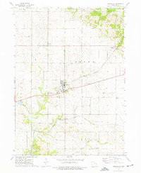
1973 Map of Springville
USGS Topo · Published 1977About this map
Big Creek and East Big Creek converge near the heart of this Linn County landscape, where the settlement of Springville serves as the primary hub of activity. The 1973 survey details a rural region defined by its rail history and agricultural layout, featuring the Chicago Milwaukee St Paul and Pacific line passing through the center of town and continuing through Viola to the northeast. An Old Railroad Grade suggests earlier transportation routes south of the main line, near the community of Paralta. Local history is well-preserved through numerous family and community burial grounds, including Gillian Cem, Springville Cem, and Simmons Cem. The land is dotted with industrial markers of the era, such as various Quarry sites and Gravel Pits, alongside smaller clusters like Whittier and Linn Grove.
Find a feature on this map
25 named features on this map. Tap any name to fly to it.
Don’t see what you’re looking for? This feature index may not catch every label — zoom into the map to look around manually.
Map Details
Editions of this 1973 Springville Map
This is the sole edition of this map. No revisions or reprints were ever made.
Other maps of this area

1887 · Cedar Rapids
USGS Topo · 1:62,500

1888 · Marion
USGS Topo · 1:62,500

1889 · Marion
USGS Topo · 1:62,500

1890 · Anamosa
USGS Topo · 1:62,500

1891 · Mechanicsville
USGS Topo · 1:62,500

1891 · Cedar Rapids
USGS Topo · 1:62,500

1894 · Mechanicsville
USGS Topo · 1:62,500

1900 · Anamosa
USGS Topo · 1:125,000

1901 · Stanwood
USGS Topo · 1:125,000

1903 · Fairfax
USGS Topo · 1:125,000