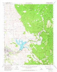
1957 Map of Springville
USGS Topo · Published 1967About this map
Porterville serves as the western anchor of this survey, where the Atchison Topeka and Santa Fe railroad meets the edge of the Sierra Nevada foothills. The landscape is dominated by the newly formed Lake Success, created by the damming of the Tule River. This hydraulic infrastructure fundamentally altered the local geography near settlements like Globe and Little Campbell, where an Old Railroad grade reflects the area's earlier transportation patterns.
Find a feature on this map
71 named features on this map. Tap any name to fly to it.
Don’t see what you’re looking for? This feature index may not catch every label — zoom into the map to look around manually.
Map Details
Editions of this 1957 Springville Map
2 editions found
Other maps of this area

1904 · Kaweah
USGS Topo · 1:125,000

1909 · Kaweah
USGS Topo · 1:125,000

1925 · Rocky Hill
USGS Topo · 1:31,680

1927 · Rocky Hill
USGS Topo · 1:31,680

1928 · Lindsay
USGS Topo · 1:31,680

1929 · Porterville
USGS Topo · 1:31,680

1929 · Ducor
USGS Topo · 1:31,680

1936 · White River
USGS Topo · 1:62,500

1936 · Tobias Peak
USGS Topo · 1:125,000

1937 · Kaweah
USGS Topo · 1:125,000