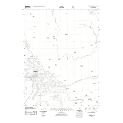
2011 Map of Springville
USGS Topo · Published 2011About this map
Springville and Mapleton occupy the valley floor at the base of the Wasatch Range in this 2011 survey. The transition from established residential grids to the high-elevation peaks is immediate, with the landscape rising sharply toward Provo Peak and Powerhouse Mountain. Local history is anchored by the Springville City Cemetery and Evergreen Cemetery, while the Springville Post Office marks the civic center. The importance of water management in this arid environment is evident through numerous named water sources like Burt Spring Pond, Wheeler Springs, and Konold Spring. Beyond the city limits, the terrain is defined by canyons and hollows, such as Slide Canyon and Deadmans Hollow, which provide natural corridors leading into the mountains. For those interested in recreation and early 21st-century infrastructure, the map details the Squaw Peak Trl and various mountain access points like Kellys Grove Picnic Area.
Find a feature on this map
61 named features on this map. Tap any name to fly to it.
Don’t see what you’re looking for? This feature index may not catch every label — zoom into the map to look around manually.
Map Details
Editions of this 2011 Springville Map
This is the sole edition of this map. No revisions or reprints were ever made.
Other maps of this area

1885 · Salt Lake
USGS Topo · 1:250,000

1907 · Strawberry Valley
USGS Topo · 1:125,000

1909 · Strawberry Valley
USGS Topo · 1:125,000

1948 · Spanish Fork
USGS Topo · 1:24,000

1948 · Orem
USGS Topo · 1:24,000

1948 · Orem
USGS Topo · 1:62,500

1948 · Springville
USGS Topo · 1:24,000

1948 · Provo
USGS Topo · 1:24,000

1948 · Bridal Veil Falls
USGS Topo · 1:24,000

1949 · Provo
USGS Topo · 1:62,500