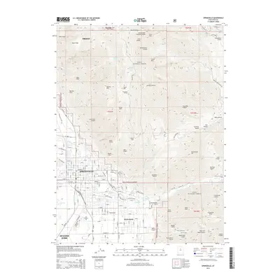
2014 Map of Springville
USGS Topo · Published 2014About this map
Springville and Mapleton serve as the focal points of this study, positioned where the valley floor meets the steep ascent of the Wasatch Range. The residential grids of these communities are clearly defined against the backdrop of the Uinta National Forest, which dominates the eastern half of the map. This area is defined by sharp topographic transitions, from the established neighborhoods around the Springville City Cem and Evergreen Cem to the high alpine reaches of Provo Peak. Water management and natural hydrology are evident through the network of mountain drainages like Hobble Cr and numerous mountain springs, including Wheeler Springs and Clyde Spring. The map illustrates how late-20th-century development pushed right to the base of the mountains, with landmarks such as the Kellys Grove Picnic Area marking the threshold between the suburban valley and the rugged canyons of Bartholomew Canyon and Slate Canyon.
Find a feature on this map
159 named features on this map. Tap any name to fly to it.
Don’t see what you’re looking for? This feature index may not catch every label — zoom into the map to look around manually.
Map Details
Editions of this 2014 Springville Map
This is the sole edition of this map. No revisions or reprints were ever made.
Other maps of this area

1885 · Salt Lake
USGS Topo · 1:250,000

1907 · Strawberry Valley
USGS Topo · 1:125,000

1909 · Strawberry Valley
USGS Topo · 1:125,000

1948 · Spanish Fork
USGS Topo · 1:24,000

1948 · Orem
USGS Topo · 1:24,000

1948 · Orem
USGS Topo · 1:62,500

1948 · Springville
USGS Topo · 1:24,000

1948 · Provo
USGS Topo · 1:24,000

1948 · Bridal Veil Falls
USGS Topo · 1:24,000

1949 · Provo
USGS Topo · 1:62,500