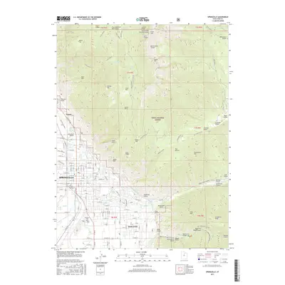
2017 Map of Springville
USGS Topo · Published 2017About this map
Springville and Mapleton occupy the fertile transition between the high peaks of the Wasatch Range and the valley floor. This 2017 study illustrates the dense street grids of these Utah County communities as they push eastward toward the rising canyon walls. The mountain front is marked by numerous drainage systems and geological features, including Slide Canyon, Slate Canyon, and the prominent Provo Peak. Within the Uinta National Forest, a network of canyons like Spring Canyon and Bartholomew Canyon define the area's geography. Genealogists will find the Historic Springville City Cem and Evergreen Cem clearly marked. The presence of Ironton at the northern edge reflects the area's industrial history, while water sources such as Fullmer Spring and Hobble Cr continue to shape the local settlement pattern and infrastructure.
Find a feature on this map
116 named features on this map. Tap any name to fly to it.
Don’t see what you’re looking for? This feature index may not catch every label — zoom into the map to look around manually.
Map Details
Editions of this 2017 Springville Map
This is the sole edition of this map. No revisions or reprints were ever made.
Other maps of this area

1885 · Salt Lake
USGS Topo · 1:250,000

1907 · Strawberry Valley
USGS Topo · 1:125,000

1909 · Strawberry Valley
USGS Topo · 1:125,000

1948 · Spanish Fork
USGS Topo · 1:24,000

1948 · Orem
USGS Topo · 1:24,000

1948 · Orem
USGS Topo · 1:62,500

1948 · Springville
USGS Topo · 1:24,000

1948 · Provo
USGS Topo · 1:24,000

1948 · Bridal Veil Falls
USGS Topo · 1:24,000

1949 · Provo
USGS Topo · 1:62,500