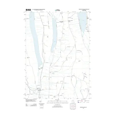
2013 Map of Springwater
USGS Topo · Published 2013About this map
Hemlock Lake, Canadice Lake, and the southern reach of Honeoye Lake define this Finger Lakes landscape, where deep glacial troughs shape the settlement patterns of western New York. The village of Springwater serves as the primary hub in the southwest corner, situated along Springwater Creek and near the steep ravine of Reynolds Gully. The upland terrain is marked by significant elevations like Bald Hill and Canadice Hill, which overlook a network of rural roads such as Canadice Hollow Road and Canadice Lake Road.
Find a feature on this map
89 named features on this map. Tap any name to fly to it.
Don’t see what you’re looking for? This feature index may not catch every label — zoom into the map to look around manually.
Map Details
Editions of this 2013 Springwater Map
This is the sole edition of this map. No revisions or reprints were ever made.
Other maps of this area

1900 · Naples
USGS Topo · 1:62,500

1900 · Canandaigua
USGS Topo · 1:62,500

1901 · Honeoye
USGS Topo · 1:62,500

1902 · Wayland
USGS Topo · 1:62,500

1903 · Naples
USGS Topo · 1:62,500

1903 · Canandaigua
USGS Topo · 1:62,500

1904 · Wayland
USGS Topo · 1:62,500

1904 · Honeoye
USGS Topo · 1:62,500

1913 · Naples
USGS Topo · 1:62,500

1942 · Springwater
USGS Topo · 1:31,680