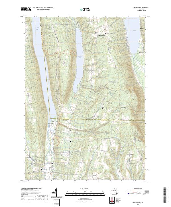
2023 Map of Springwater
USGS Topo · Published 2023About this map
The Finger Lakes region of New York presents a striking landscape of high ridges and narrow glacial lakes, where Canadice Lake and Hemlock Lake are flanked by prominent terrain like Bald Hill and Marrowback Hill. This area is defined by the steep elevation changes of the Springwater Creek and Canadice Outlet drainage basins. Local history is anchored by the settlements of Springwater and Canadice Corners, alongside a significant concentration of family and community burial grounds including Mount Vernon Evergreen Cem, Tibbalds Cem, and Ford Cem. The presence of Punky Hollow and Green Gully illustrates the deeply carved valleys characteristic of the Ontario and Livingston County line. The mapping of the Cohocton River headwaters provides critical context for the watershed divide that separates the northward-flowing lakes from the Susquehanna River basin to the south.
Find a feature on this map
83 named features on this map. Tap any name to fly to it.
Don’t see what you’re looking for? This feature index may not catch every label — zoom into the map to look around manually.
Map Details
Editions of this 2023 Springwater Map
This is the sole edition of this map. No revisions or reprints were ever made.
Other maps of this area

1900 · Naples
USGS Topo · 1:62,500

1900 · Canandaigua
USGS Topo · 1:62,500

1901 · Honeoye
USGS Topo · 1:62,500

1902 · Wayland
USGS Topo · 1:62,500

1903 · Naples
USGS Topo · 1:62,500

1903 · Canandaigua
USGS Topo · 1:62,500

1904 · Wayland
USGS Topo · 1:62,500

1904 · Honeoye
USGS Topo · 1:62,500

1913 · Naples
USGS Topo · 1:62,500

1942 · Springwater
USGS Topo · 1:31,680