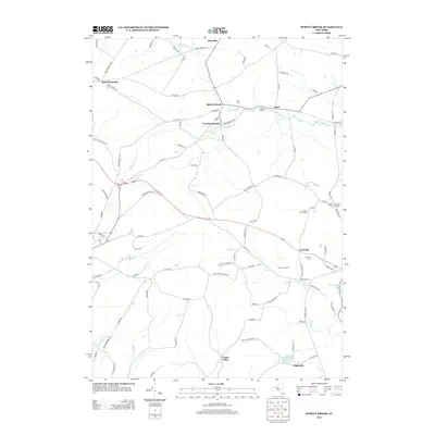
2013 Map of Sprout Brook
USGS Topo · Published 2013About this map
Sprout Brook and its neighboring hamlets define this rural Montgomery County landscape, where the headwaters of several key creeks converge. The terrain is marked by the branching paths of Bowmans Cr and Canajoharie Cr, which dictated the early settlement patterns of villages like Salt Springville and Van Deusenville. This survey reflects a deeply established agricultural community, evidenced by the numerous family and community burial grounds including Flint Cem, Coleman Cem, and McFee Cem.
Find a feature on this map
97 named features on this map. Tap any name to fly to it.
Don’t see what you’re looking for? This feature index may not catch every label — zoom into the map to look around manually.
Map Details
Editions of this 2013 Sprout Brook Map
This is the sole edition of this map. No revisions or reprints were ever made.
Other maps of this area

1898 · Canajoharie
USGS Topo · 1:62,500

1900 · Canajoharie
USGS Topo · 1:62,500

1902 · Canajoharie
USGS Topo · 1:62,500

1903 · Richfield Springs
USGS Topo · 1:62,500

1904 · Richmondville
USGS Topo · 1:62,500

1907 · Cooperstown
USGS Topo · 1:62,500

1909 · Cooperstown
USGS Topo · 1:62,500

1943 · South Valley
USGS Topo · 1:24,000

1943 · Sharon Springs
USGS Topo · 1:24,000
1943 · Sprout Brook
USGS Topo · 1:24,000