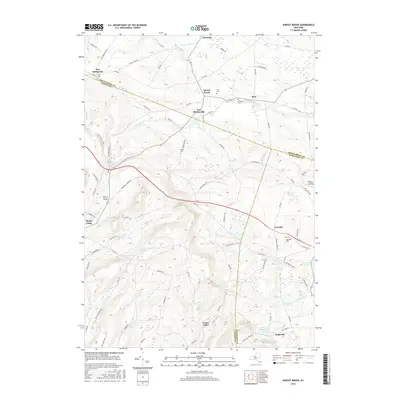
2016 Map of Sprout Brook
USGS Topo · Published 2016About this map
Canajoharie Creek and its tributaries carve through the upland borders where Montgomery, Otsego, and Schoharie Counties meet. This 2016 survey documents a rural landscape defined by historic hamlets and family-named landmarks. The village of Sprout Brook sits centrally near Flint Cemetery, while Salt Springville marks the western edge near the Otsego County line. The settlement pattern remains largely agricultural, connected by a network of county roads like Hess Rd and Otsego Rd. Genealogists will find significant value in the mapped locations of several burial grounds, including the McFee Cemetery and Leesville Cemetery. To the south, the terrain rises toward Lady Hill Ln before descending into the valley near Engleville Pond and the small community of Engleville. The presence of Judds Falls and Bowmaker Pond highlights the water-rich topography that historically supported local milling and farming operations in this corner of the Mohawk Valley region.
Find a feature on this map
87 named features on this map. Tap any name to fly to it.
Don’t see what you’re looking for? This feature index may not catch every label — zoom into the map to look around manually.
Map Details
Editions of this 2016 Sprout Brook Map
This is the sole edition of this map. No revisions or reprints were ever made.
Other maps of this area

1898 · Canajoharie
USGS Topo · 1:62,500

1900 · Canajoharie
USGS Topo · 1:62,500

1902 · Canajoharie
USGS Topo · 1:62,500

1903 · Richfield Springs
USGS Topo · 1:62,500

1904 · Richmondville
USGS Topo · 1:62,500

1907 · Cooperstown
USGS Topo · 1:62,500

1909 · Cooperstown
USGS Topo · 1:62,500

1943 · South Valley
USGS Topo · 1:24,000

1943 · Sharon Springs
USGS Topo · 1:24,000
1943 · Sprout Brook
USGS Topo · 1:24,000