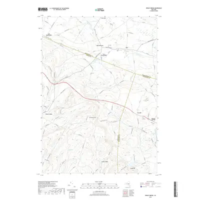
2019 Map of Sprout Brook
USGS Topo · Published 2019About this map
Mt Independence stands as a prominent high point in this rural landscape where the boundaries of Montgomery, Otsego, and Schoharie counties converge. This 2019 survey captures a series of upland settlements including Salt Springville, Sprout Brook, and Sharon Springs, connected by a network of historic county roads and trails like Indian Trail Rd. The drainage patterns of Canajoharie Creek and its namesake Sprout Brook dictate the valley-floor orientation of small hamlets like Van Deusenville and Buel.
Find a feature on this map
90 named features on this map. Tap any name to fly to it.
Don’t see what you’re looking for? This feature index may not catch every label — zoom into the map to look around manually.
Map Details
Editions of this 2019 Sprout Brook Map
This is the sole edition of this map. No revisions or reprints were ever made.
Other maps of this area

1898 · Canajoharie
USGS Topo · 1:62,500

1900 · Canajoharie
USGS Topo · 1:62,500

1902 · Canajoharie
USGS Topo · 1:62,500

1903 · Richfield Springs
USGS Topo · 1:62,500

1904 · Richmondville
USGS Topo · 1:62,500

1907 · Cooperstown
USGS Topo · 1:62,500

1909 · Cooperstown
USGS Topo · 1:62,500

1943 · South Valley
USGS Topo · 1:24,000

1943 · Sharon Springs
USGS Topo · 1:24,000
1943 · Sprout Brook
USGS Topo · 1:24,000