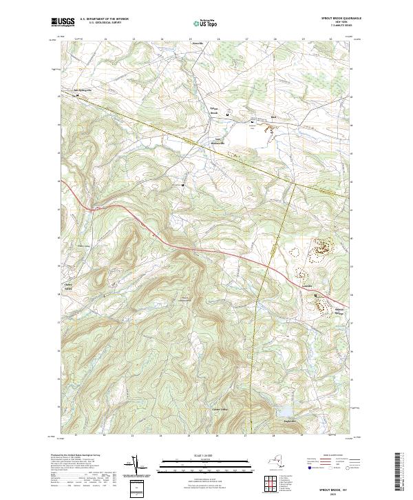
2023 Map of Sprout Brook
USGS Topo · Published 2023About this map
Sharon Springs and the village of Cherry Valley anchor this detailed study of the rolling uplands at the intersection of Otsego, Schoharie, and Montgomery counties. The landscape is defined by the headwaters of several critical drainages, including Canajoharie Creek and West Creek, which carve through the high ground surrounding Mount Independence. Small 19th-century hamlets like Salt Springville and Sprout Brook remain central to the local road network, which still follows historic alignments like the Indian Trail Rd and Luenburgh Tpke. For genealogists and local historians, the map documents several rural burial grounds such as Flint Cem and Coleman Cem, which are often the only remaining physical markers of the area's earliest farming families. The settlement pattern remains largely agricultural, with clusters of development at Leesville and Engleville near the tranquil Engleville Pond.
Find a feature on this map
93 named features on this map. Tap any name to fly to it.
Don’t see what you’re looking for? This feature index may not catch every label — zoom into the map to look around manually.
Map Details
Editions of this 2023 Sprout Brook Map
This is the sole edition of this map. No revisions or reprints were ever made.
Other maps of this area

1898 · Canajoharie
USGS Topo · 1:62,500

1900 · Canajoharie
USGS Topo · 1:62,500

1902 · Canajoharie
USGS Topo · 1:62,500

1903 · Richfield Springs
USGS Topo · 1:62,500

1904 · Richmondville
USGS Topo · 1:62,500

1907 · Cooperstown
USGS Topo · 1:62,500

1909 · Cooperstown
USGS Topo · 1:62,500

1943 · South Valley
USGS Topo · 1:24,000

1943 · Sharon Springs
USGS Topo · 1:24,000
1943 · Sprout Brook
USGS Topo · 1:24,000