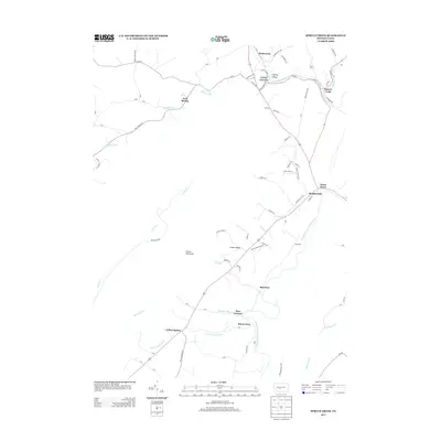
2013 Map of Spruce Creek
USGS Topo · Published 2013About this map
Etna Furnace and Union Furnace stand as industrial markers in this central Pennsylvania landscape, where the valley's geological resources historically supported iron production. The drainage network is dominated by the Frankstown Br Juniata River and the Little Juniata River, which converge near the settlement of Spruce Creek. This 2013 survey reveals a pattern of rural communities such as Yellow Spring, Blairfour, and Shaffersville that follow the natural corridors of Canoe Valley beneath the ridge of Canoe Mountain. Notable hydrologic features like Arch Spring and Sinking Run reflect the limestone-rich topography of Sinking Valley, where water often disappears into the subsurface. These named springs and runs have long dictated the placement of early homesteads and small-scale industry throughout the region.
Find a feature on this map
82 named features on this map. Tap any name to fly to it.
Don’t see what you’re looking for? This feature index may not catch every label — zoom into the map to look around manually.
Map Details
Editions of this 2013 Spruce Creek Map
This is the sole edition of this map. No revisions or reprints were ever made.
Other maps of this area

1901 · Huntingdon
USGS Topo · 1:62,500

1902 · Hollidaysburg
USGS Topo · 1:62,500

1903 · Hollidaysburg
USGS Topo · 1:62,500

1904 · Huntingdon
USGS Topo · 1:62,500

1920 · Altoona
USGS Topo · 1:62,500

1922 · Altoona
USGS Topo · 1:62,500

1923 · Tyrone
USGS Topo · 1:62,500

1929 · Tyrone
USGS Topo · 1:48,000

1933 · Tyrone
USGS Topo · 1:62,500

1946 · Tyrone
USGS Topo · 1:62,500
Featured Places
- Frankstown Township, PA
- Spruce Creek Township, PA
- Mount Etna, Catharine Township
- Blairfour, Morris Township
- Arch Springs, Tyrone Township