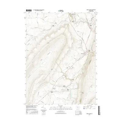
2016 Map of Spruce Creek
USGS Topo · Published 2016About this map
Union Furnace and Etna Furnace anchor this section of the Central Pennsylvania landscape, reflecting the industrial heritage of the Juniata Valley. The terrain is defined by the parallel ridges of Brush Mtn, Canoe Mtn, and Tussey Mountain, which funnel the Frankstown Branch Juniata River and the Little Juniata River through narrow gaps. These water gaps served as natural corridors for both early transit and later settlement patterns at Water Street and Spruce Creek. Genealogists will find a wealth of burial sites scattered across the valley floors, including the Sinking Valley Cem near Arch Spring and the Yellow Springs Henrys Lutheran Cem further south. The map details a network of rural routes like Arch Spring Rd and Shaffersville Rd that connect small crossroads communities such as Shaffersville and Pemberton amidst the valley's drainage systems.
Find a feature on this map
82 named features on this map. Tap any name to fly to it.
Don’t see what you’re looking for? This feature index may not catch every label — zoom into the map to look around manually.
Map Details
Editions of this 2016 Spruce Creek Map
This is the sole edition of this map. No revisions or reprints were ever made.
Other maps of this area

1901 · Huntingdon
USGS Topo · 1:62,500

1902 · Hollidaysburg
USGS Topo · 1:62,500

1903 · Hollidaysburg
USGS Topo · 1:62,500

1904 · Huntingdon
USGS Topo · 1:62,500

1920 · Altoona
USGS Topo · 1:62,500

1922 · Altoona
USGS Topo · 1:62,500

1923 · Tyrone
USGS Topo · 1:62,500

1929 · Tyrone
USGS Topo · 1:48,000

1933 · Tyrone
USGS Topo · 1:62,500

1946 · Tyrone
USGS Topo · 1:62,500
Featured Places
- Frankstown Township, PA
- Spruce Creek Township, PA
- Mount Etna, Catharine Township
- Blairfour, Morris Township
- Arch Springs, Tyrone Township