
1961 Map of Spruce Mountain
USGS Topo · Published 1971About this map
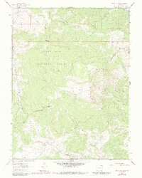
The convergence of three major national forests—White River National Forest, Grand Mesa National Forest, and Gunnison National Forest—defines this high-elevation landscape in the early 1960s. Surveyed just before development changed many such areas, the map documents a terrain managed for both resource extraction and seasonal grazing. The presence of Oil Well Camp and an identified Oil Well near the center of the sheet highlights the industrial activity penetrating these highlands, while the remote Buzzard Cow Camp suggests the continued importance of high-country ranching. Water management is critical in this environment, evidenced by the Gaging Station on Muddy Creek and various named springs like Cox Spring. Descriptive terrain names like The Burn, Logpile Flat, and No Good Park provide local character and insight into the historical land use and natural events that shaped these plateaus.
Find a feature on this map
39 named features on this map. Tap any name to fly to it.
Don’t see what you’re looking for? This feature index may not catch every label — zoom into the map to look around manually.
Map Details
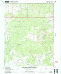
Editions of this 1961 Spruce Mountain Map
4 editions found
Other maps of this area

1957 · Leadville
USGS Topo · 1:250,000

1959 · Leadville
USGS Topo · 1:250,000

1960 · Leadville
USGS Topo · 1:250,000

1961 · Electric Mountain
USGS Topo · 1:24,000

1961 · Porter Mountain
USGS Topo · 1:24,000

1961 · Chalk Mountain
USGS Topo · 1:24,000

1961 · Spruce Mountain
USGS Topo · 1:24,000

1962 · Leadville
USGS Topo · 1:250,000
1963 · Flatiron Mountain
USGS Topo · 1:24,000
1963 · Hightower Mountain
USGS Topo · 1:24,000