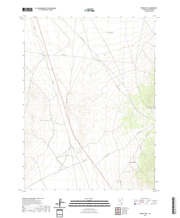
2021 Map of Spruce Well
USGS Topo · Published 2021About this map
Clover Valley defines the eastern expanse of this high-desert landscape in Elko County, where the hydrology is dominated by the seasonal drainage of Laurel Run. The area serves as a significant junction for transit routes through the Great Basin, anchored by the path of Old Hwy 93 and a network of Bureau of Land Management access roads. This infrastructure reflects the region's historical and ongoing role in mining and ranching, with dedicated routes like Spruce Mtn Rd, Old Sprucemont Rd, and Spruce Well Rd branching off toward the surrounding highlands. The survey meticulously documents the township and range boundaries, such as t32n r62e and t31n r63e, providing a precise framework for understanding land tenure and historical claims in this open Nevada terrain.
Find a feature on this map
16 named features on this map. Tap any name to fly to it.
Don’t see what you’re looking for? This feature index may not catch every label — zoom into the map to look around manually.
Map Details
Editions of this 2021 Spruce Well Map
This is the sole edition of this map. No revisions or reprints were ever made.
Other maps of this area

1935 · Halleck
USGS Topo · 1:125,000

1953 · Spruce Mountain
USGS Topo · 1:62,500

1955 · Elko
USGS Topo · 1:250,000

1958 · Elko
USGS Topo · 1:250,000

1962 · Elko
USGS Topo · 1:250,000

1965 · Elko
USGS Topo · 1:250,000
1984 · Arizona Spring
USGS Topo · 1:24,000

1984 · Valley Mtn
USGS Topo · 1:24,000

1984 · Delcer Buttes
USGS Topo · 1:24,000
1984 · Palomino Well
USGS Topo · 1:24,000