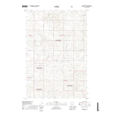
2018 Map of Square Butte
USGS Topo · Published 2018About this map
Square Butte rises above the drainage networks of Golden Valley County, serving as the dominant topographic landmark in this stretch of western North Dakota. This landscape is largely defined by the sprawling Little Missouri National Grassland, where the terrain is carved by seasonal watercourses such as Fisher Run, Garner Cr, and Dry Cr. The map reveals a sparsely populated ranching environment where section lines and section corners dictate the placement of local thoroughfares like Square Butte Rd and Garner Creek Rd. This 2018 survey illustrates the persistent rural character of the Great Plains, where land use remains tied to expansive grazing territories and the natural contours of the badlands-adjacent topography.
Find a feature on this map
13 named features on this map. Tap any name to fly to it.
Don’t see what you’re looking for? This feature index may not catch every label — zoom into the map to look around manually.
Map Details
Editions of this 2018 Square Butte Map
This is the sole edition of this map. No revisions or reprints were ever made.
Other maps of this area

1953 · Dickinson
USGS Topo · 1:250,000

1957 · Dickinson
USGS Topo · 1:250,000

1970 · Medora
USGS Topo · 1:24,000

1979 · Sentinel Butte SE
USGS Topo · 1:24,000
1979 · Buffalo Gap Campground
USGS Topo · 1:24,000
1979 · Chimney Butte
USGS Topo · 1:24,000

1979 · Square Butte
USGS Topo · 1:24,000

1979 · Bullion Butte
USGS Topo · 1:24,000
1980 · Sentinel Butte
USGS Topo · 1:24,000

1980 · Alpha
USGS Topo · 1:24,000