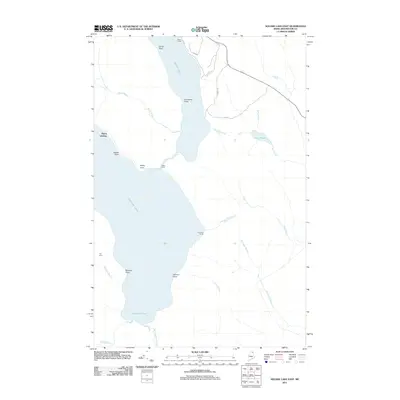
2011 Map of Square Lake East
USGS Topo · Published 2011About this map
The vast waters of Square Lake and Cross Lake dominate this North Woods landscape in Aroostook County, Maine. Scattered throughout the lakeside timber and shoreline are seasonal and remote outposts like Austin Camp, Fraser Camp, and Gorfinkle Camp, marking the region's enduring tradition of wilderness sporting and recreation. The geography of the lake system is detailed through numerous named features including Salmon Point, Dinah Point, and Goddard Cove.
Find a feature on this map
27 named features on this map. Tap any name to fly to it.
Don’t see what you’re looking for? This feature index may not catch every label — zoom into the map to look around manually.
Map Details
Editions of this 2011 Square Lake East Map
This is the sole edition of this map. No revisions or reprints were ever made.
Other maps of this area

1927 · Stockholm
USGS Topo · 1:48,000

1927 · Square Lake
USGS Topo · 1:48,000

1929 · Portage
USGS Topo · 1:62,500

1929 · Caribou
USGS Topo · 1:48,000

1931 · Square Lake
USGS Topo · 1:62,500

1931 · Portage
USGS Topo · 1:62,500

1931 · Stockholm
USGS Topo · 1:62,500

1932 · Caribou
USGS Topo · 1:62,500

1953 · Stockholm
USGS Topo · 1:62,500

1953 · Square Lake
USGS Topo · 1:62,500