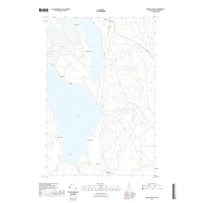
2021 Map of Square Lake East
USGS Topo · Published 2021About this map
Square Lake and Cross Lake dominate this northern Maine landscape, where the waterways of Aroostook County have long shaped local geography. The map reveals a series of prominent shoreline features including Dinah Point, Salmon Point, and Cranberry Point, while Square Lake Ridge rises above the eastern shore. This modern survey illustrates the persistent rural character of the region, anchored by the Saint Etropus Cem near the junction of Caribou Rd and St Peter Rd.
Find a feature on this map
27 named features on this map. Tap any name to fly to it.
Don’t see what you’re looking for? This feature index may not catch every label — zoom into the map to look around manually.
Map Details
Editions of this 2021 Square Lake East Map
This is the sole edition of this map. No revisions or reprints were ever made.
Other maps of this area

1927 · Stockholm
USGS Topo · 1:48,000

1927 · Square Lake
USGS Topo · 1:48,000

1929 · Portage
USGS Topo · 1:62,500

1929 · Caribou
USGS Topo · 1:48,000

1931 · Square Lake
USGS Topo · 1:62,500

1931 · Portage
USGS Topo · 1:62,500

1931 · Stockholm
USGS Topo · 1:62,500

1932 · Caribou
USGS Topo · 1:62,500

1953 · Stockholm
USGS Topo · 1:62,500

1953 · Square Lake
USGS Topo · 1:62,500